Over the course of 10 years of partnership, the World Bank has supported efforts by the government of Vanuatu to build the skills and institutions it needs to deal with the many volcanic eruptions and earthquakes it is prone to as well as the increasingly frequent and severe cyclones. This collaboration and institutional strengthening with one of the world’s most climate-vulnerable countries could serve as a model for other small island states as climate impacts worsen around the world.
Committed local experts leading the way
The World Bank has been working in Vanuatu since the 1980s. Over the past decade, much of its work there has focused on disaster risk management, including building on the geohazard monitoring work that Dr. Esline Garaebiti began back in 1997.
Dr. Garaebiti, one of the first female geoscientists in the Pacific and a recipient of a Women’s International Network for Disaster Risk Reduction Leadership Award, is the Director General of Vanuatu’s Ministry of Climate Change. Born on a volcanic island, Esline discovered her passion for earth science as an undergraduate. In 1997, she joined a French organization implementing Vanuatu’s first geohazard monitoring. She then become the geohazards manager for the government of Vanuatu before assuming her current post, in 2020.
Tevi Obed is the World Bank’s Senior Disaster Risk Management Specialist in Vanuatu. Like Director General Garaebiti, he was born in Vanuatu and has spent his life living through disasters and working to reduce their impact. His relationship working with government officials spans back to his school days, when he studied with many of the people who now hold government positions. “What I can offer to the partnership with the government is to be relevant, trusted, and strategic over the long term,” he explains. “I will always be here.”
Obed has worked with Director General Garaebiti to improve Vanuatu’s monitoring network. “The World Bank helped develop Vanuatu’s seismic monitoring network and link it to a national multi-hazard warning center. These stations around the country transmit real-time data to the national center, which killed Vanuatu analysts and forecasters interpret,” he explained. As a result of these efforts, Vanuatu is now a leader in geohazard monitoring. It has helped establish a regional network within the Pacific to share data with other countries.
Seismologists in Vanuatu detect up to 100 earthquakes every day. In 2017, a huge eruption on Ambae Island was recorded, triggering the evacuation of 11,000 residents. “It was one of the biggest volcanic eruptions we have ever seen on that island,” said Dr. Garaebiti. “It was the first eruption with recorded data.”
In addition to the risk of earthquakes and volcanic eruptions, Vanuatu is facing increasingly frequent and severe cyclones. In 2015, the most severe storm ever recorded in the South Pacific struck. “Our weather forecasters tracked Tropical Cyclone Pam every hour. Their desks flooded—but they moved everything to the other side of the partition and kept working, even though the cyclone was on top of them,” she said.
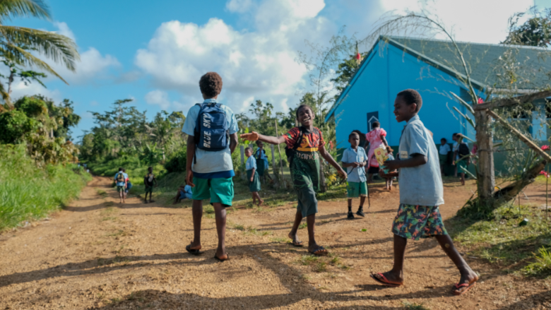
In response to Tropical Cyclone Pam, the World Bank invested US$50 million in Vanuatu, building and repairing 50 kilometers of roads and reconstructing 42 schools and 26 buildings across 20 islands. These stronger, more climate-resilient schools have been used as community shelters in the subsequent cyclones Vanuatu has faced.
Students walk down a road in Roau, Vanuatu, that was reconstructed under a World Bank/Government of Vanuatu project ensuring students had better access to education following devastating tropical cyclones. (C) Hamish Wyatt/World Bank


