Challenge
In November 2011, Haiti was still recovering from the earthquake of January 12, 2010, the worst humanitarian disaster in recorded history in Latin America and the Caribbean. The earthquake killed an estimated 220,000 people and displaced 1.5 million people; damages, including but not limited to housing, agriculture, water and sanitation, education, transport, health, and energy, were valued at US$7.8 billion. Furthermore, earthquake-related damage to the transport sector hindered prompt access and response to regions prone to hurricanes and flooding. The disaster revealed important shortcomings in Haiti's overall national disaster risk management system. After the January 2010 earthquake, reducing vulnerability, improving emergency preparedness and response capacity, and understanding risks became key themes for Haiti’s government and the international community.

Approach
The Disaster Risk Management and Reconstruction project focused on (i) supporting Haiti to improve its disaster response capacity, and (ii) enhancing the resilience of critical transport infrastructure. The project aimed to bring together the disaster risk management (DRM) and transport sectors to build local capacity and promote shared knowledge and coordination. On the DRM side, the project sought to improve risk assessment capacity by generating key risk data using earth observation, remote sensing technology, and hydrological risk models. Strengthening citizen engagement was also a critical aspect to enhance emergency preparedness and response through early warnings, emergency evacuation, and emergency shelter management. On the transport side, the project utilized hydrological models and multi-hazard maps to bring to bear innovative, reliable, and cost-efficient engineering solutions, both for post-disaster reconstruction and to build a more resilient road network. Men and women were trained as skilled laborers to carry out labor-intensive work, creating job opportunities in mainly poor areas. The project design was innovative at the time by incorporating a US$1 million contingent emergency response component that could be triggered in case of national emergency, which has since become a common feature in Bank-financed investment projects.

Results
During project implementation (2012–2020), the Disaster Risk Management and Reconstruction Project achieved the following key outcomes:
Improving disaster response capacity
- Two key ministries — Health and Education — strengthened their disaster risk management capacity by developing sector-specific disaster risk management plans.
- Training in disaster risk management was delivered to 127 ministry officials and 1,520 beneficiaries.
- Risk assessment capacity was improved by generating key risk data using earth observation, remote sensing technology, and hydrological risk modeling.
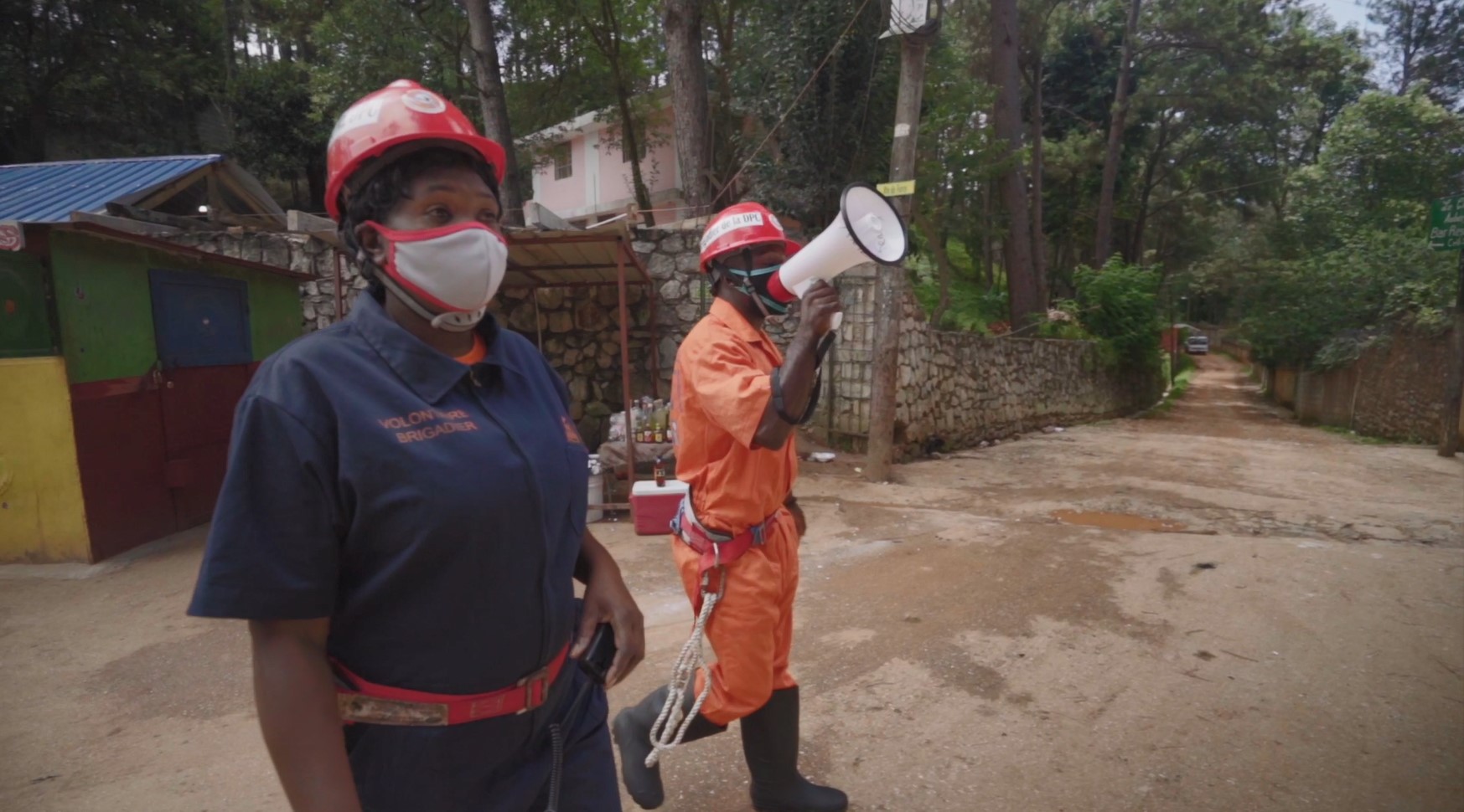
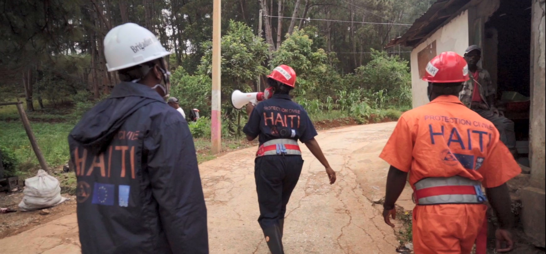
- The Municipal Civil Protection Committees (CCPCs) were expanded from 73 to 140 to cover all municipalities in the country with a level 2 certification, and 2,800 CCPC volunteers were trained to provide emergency services to the population. (CCPC capacity is evaluated by Haiti’s Directorate for Civil Protection, which assigns each CCPC a score ranging from 1 to 4, depending on organizational and functional factors combined in a performance index. CCPCs assigned a ‘1’ are deemed ‘Excellent’, those assigned ‘2’, ‘3’ and ‘4’ are assessed as ‘Good’, ‘Average’ and ‘Weak’ respectively.)
- A roadmap to provide a legal basis for the DRM system was developed, leading to adoption in 2020 of the national DRM system and creation of the General Civil Protection Directorate (DGPC). These changes better position civil protection structures at the national level and dynamize and strengthen the system’s structures at both the central and the territorial level.
- DGPC’s institutional mandate to coordinate the DRM system strengthened Haiti’s disaster risk management capacity, as evidenced by DGPC’s strong coordination of the emergency response following the 2021 earthquake.
- Seven emergency shelters were rehabilitated in rural areas in the South Department.
Enhancing the resiliency of critical transport infrastructure
- Improved and resilient investment on the road network benefited 150,000 people.
- Road structures requiring urgent interventions were rehabilitated before they fell to a level beyond repair. This included rehabilitation of 120 kilometers (km) of roads, construction or rehabilitation of 6 bridges, completion of 112 spot interventions to protect local access, and repair or consolidation of 27 bridges and road sections damaged by Hurricane Matthew.
- The project built the capacity of the Ministry of Public Works, Transport, and Communication (MTPTC) at the national level as well as that of beneficiaries at the commune levels, while also creating job opportunities. MTPTC’s increased capacity was exhibited in the aftermath of the 2021 earthquake; the Ministry contributed to a strong emergency response, clearing roads and gravel and conducting assessments of damaged buildings.
Bank Group Contribution
The World Bank, through the International Development Association (IDA), provided a grant in the amount of US$60 million to finance this project. Emergency additional financing of US$20 million was subsequently provided through the IDA Crisis Response Window to respond to the impact of Hurricane Matthew.
Partners
Other DRM programs and projects carried out by the Haitian government and development partners maintained close collaboration with the Bank team to leverage the results of Bank-financed DRM operations and advance capacity building. These successful partnerships included a US$24.5 million grant from the Climate Investment Funds (CIF) Bank Pilot Program for Climate Resilience (PPCR) to finance the Haiti Strategic Program for Climate Resilience (SPCR), coordinated between 2011 and 2015 by the Comité Interministériel d’Aménagement du Territoire (CIAT), and US$500,000 in financing for the Technical Assistance Program from the European Union in 2018–2020.
Beneficiaries
Over 2,800 members of CCPCs, covering the whole country of 11.4 million people, received training that strengthened their capacity to evacuate at-risk populations, and this training has already been instrumental in saving lives, as evidenced by the response to the 2021 earthquake. The CCPCs’ role is crucial in the National Risk and Disaster Management System (Système National de Gestion des Risques et des Désastres, SNGRD), as they are the closest to the population and can go door-to-door to explain early warning systems, communicate active alerts, and organize their community for evacuation when a disaster is anticipated. The CCPCs are volunteer organizations, and they have successfully engaged in Haiti’s most adverse natural events, including Hurricane Matthew in 2016. Acting in rural areas with limited access to traditional communication channels (phones, radios, or newspapers), these volunteers can reach even the most isolated people.
“We've seen in the last few years that these [disasters] are more frequent and more powerful because of climate change,” says Jerry Chandler, a surgeon and disaster medical specialist who leads Haiti’s disaster risk management agency, the General Directorate of Civil Protection (DGPC). “People need to know exactly what they’re up against, so they can adjust and adapt their lives,” says Chandler.
In addition, Haitian society as a whole benefits from the timely use of new tools to better assess disaster risks, with the support of the more than 1,000 individuals who received disaster risk management training.
“Thanks to the support of the World Bank and the financing of spatial data production, open data platforms, and technical training, DRM activities in Haiti received major benefits,” says Boby Emmanuel Piard, Director General of National Geo-Spatial Information Center (CNIGS). “Spatial analysis, Digital Elevation Models, and hazard layers have been key in assisting decision making, public investment, and planning for both preparedness and response (emergency shelters location, damage and loss assessment, humanitarian support, etc.). The use of new technologies for data collection via mobile application and GIS remote sensing were relevant to connect field studies and laboratory evaluation helping local communities and DRM emergency committees.”
Moving Forward
Key activities and systems developed under the project, including the enacted National DRM System, the earth observation knowledge base, risk assessments, communications and early warning systems, and improved road sections, are being further strengthened by ongoing IDA-financed projects in the urban, DRM, and transport sectors and are expected to contribute to subsequent initiatives. The data and knowledge base developed with the project’s support is now used by the government, development partners, academia, NGOs, and beneficiaries to formulate strategies, shape policies, and design programs and projects to better manage future disaster risks. A recent example is the response to the August 2021 earthquake, during which the Government was able to: (i) effectively mobilize CCPCs at the municipal level; (ii) conduct a rapid and sound evaluation of damages and losses rooted in sound disaster risk and impact data; and (iii) exhibit stronger coordination among institutional actors in the DRM system.
