- What is the 2022 Syria Joint Damage Assessment?
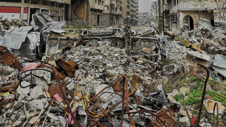
The 2022 Syria Joint Damage Assessment (DA) provides an overview of the effects of the ongoing conflict in Syria on the population, physical infrastructure, and quality of service delivery in selected cities. Conducted by the World Bank, with the financial support of and in collaboration with the European Union, the DA is a broad-brush and largely remote-based exercise that draws on satellite imagery, remotely collected data, secondary sources of information, and publicly available ground-based assessments to assess damage to physical infrastructure assets and the accessibility and provision of public services. While all efforts have been made to ensure accuracy, this damage assessment is not comprehensive for all cities and regions and provides estimates only for select cities and sectors to the extent possible.
- What does the 2022 Syria DA cover?
Temporal Scope: The Syrian crisis started in 2011; therefore, the damage is calculated against the actual or estimated pre-2011 baseline of physical assets, established in the December 2014 assessment.
Geographic scope: The 2022 Syria DA covers 14 selected cities: Afrin, Aleppo, Dar’a, Daraya, Deir-ez-Zor, Al Hasakah, Homs, Idlib, Manbij, Palmyra, Ar-Raqqa, Rastan, Tell Abiad, and Zabadani.
The selection of cities for this assessment was based on several criteria - the extent of physical damage caused by the conflict, the security conditions, the accessibility of the area, the presence of humanitarian actors, the ethnic diversity of the population, the mix of government and opposition-controlled areas, and the number of internally displaced people (IDPs).
Sectoral scope: Sectors were decided through a combination of factors including data access and impact. The 2022 Syria DA covers the following eleven selected sectors:
- Physical infrastructure sectors: Transport, Electricity, Water Supply and Sanitation (WSS), Municipal Services, Cultural Heritage, and Agri-food Value Chains.
- Social sectors: Housing, Health, and Education.
- Cross-cutting sectors: Environment, and Public Institutions.
- How was the data collected?
The DA relies primarily on a remote-based assessment methodology, and uses high resolution satellite imagery, social media analytics, mobile signal data and publicly available information corroborated and validated by other sources and means, including data from partners, the European Union, and the Joint Research Center (JRC). The 2022 Syria DA adapts from the Post-Disaster Needs Assessment (PDNA) methodology jointly developed by the European Union, World Bank, and United Nations. In line with this methodology, damage was calculated against the actual or estimated pre-2011 baseline of physical assets gathered from pre-crisis government sources and crowdsourced mapping data, and therefore describe assets prior to the crisis.
- What are the key findings of the 2022 Syria DA?
The 2022 Syria DA finds that as of January 2022, total damage across the assessed cities and sectors was estimated at US$ 8.7–11.4 billion. Of the total damage estimate, 68% of damage or US$5.80–7.8 billion was attributed to the Physical Infrastructure sectors, 30% or US$2.7–3.3 billion to damage in the Social Sectors, and 2% or US$175-278 million to Cross-Cutting sectors. The functionality of agri-food value chains was the most distorted by the conflict. Syria’s wholesale vegetable markets have been damaged, with 82% of markets assessed as either partially damaged or totally destroyed in the conflict. While the operational status of assets varies across sectors and cities, the enabling conditions play a significant role in the functionality of sectors. For example, although a large part of the physical infrastructure was undamaged in the WASH sector, 51% of assets suffered from reduced functionality, including 11% totally not functioning, which is a significant problem for the most affected cities.
- How is this 2022 Syria DA different from other DAs previously conducted by the WB?
This report is the sixth World Bank Group assessment conducted during the ongoing conflict in Syria; however, it is the first conducted jointly with the European Union. The DA distinguishes itself from previous ones by expanding the geographic and sectoral scope. More cities were assessed, in addition to the Agri-food Value Chains, Municipal Services, Cultural Heritage, and Environmental sectors that have been added. Similar remote-based damage detection methods were used in this assessment as in previous assessments, which allowed each new iteration to update the damages compared to an established baseline.
- Who is the Syria DA intended to inform?
By establishing baselines and updating damage estimates, the 2022 Syria DA serves as a corner stone for future discussions with the international community on Syria and provides a working model for scaling-up when a comprehensive Damage and Needs Assessment (DNA) and additional forward-looking assessments and analytical work are needed.
